
Walk a New Berlin Street
A useful New Berlin street directory search moves from the address to the parcel, then from the parcel to other records. Ownership and occupancy are different facts. Waukesha County Tax Listing can show information attached to an identified parcel, but the county does not provide an internet-wide owner-name property search. MyVote may show voter-service information for a supplied address, yet registration is not proof that each person still lives there. Historical directories and newspapers can describe an older household without proving a current one.
Keep a short research log with the exact address, source, date checked, tax key, and legal description. That makes it possible to distinguish a current tax entry from an older deed or map. Follow this street-by-street sequence:
- Standardize the mailing form through USPS, while remembering that a ZIP result does not prove anyone occupies the site.
- Search Waukesha County Tax Listing by the address or tax key and open Property Details.
- Inspect the same parcel and nearby lots in county GIS, noting the map date and disclaimer.
- Carry the legal description into the Register of Deeds tools to locate instruments and earlier owners.
- Use MyVote or a lawful voter-list request only for the limited election facts those services publish.
- For past occupants, add library databases, newspapers, the 1873 atlas and directory, and city archives.
New Berlin Address Search Fields
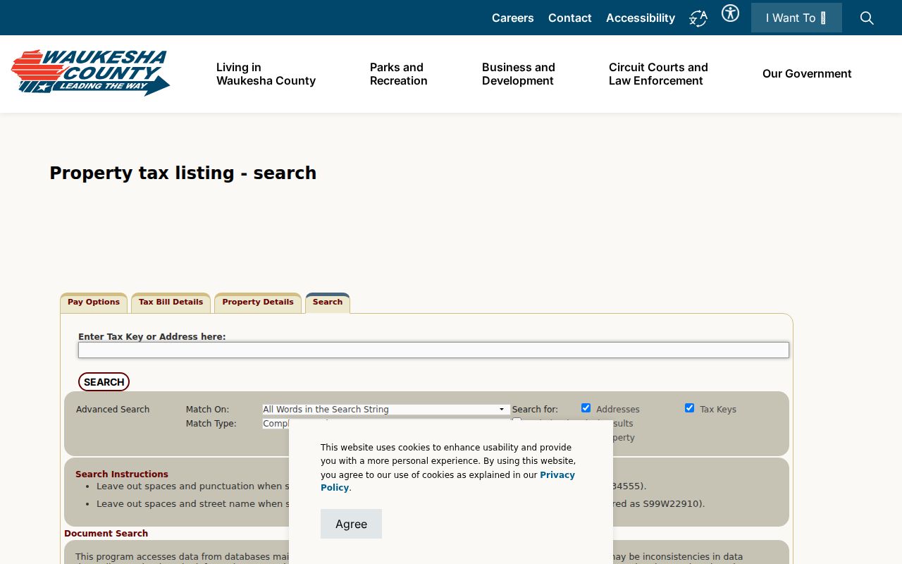
The Waukesha County Tax Listing is the main address-to-parcel route. Its simple search accepts a tax key or address. The advanced screen adds municipality, street number, prefix, street name, street type, unit, and ZIP. New Berlin grid-style addresses need special care. County instructions give a format such as S99W22910 and say to omit the street name for that method. A wrong directional letter or unit can return the wrong lot or no lot at all.
| Search field | How to use it | Why it matters |
|---|---|---|
| Tax Key | Enter the known parcel identifier | Most direct parcel match |
| Address | Use the full current site address | Starts a by-address search |
| Municipality | Select City of New Berlin | Limits similar street names |
| Number and prefix | Preserve grid direction and digits | Avoids false or empty results |
| Street and unit | Separate each element | Helps with shared sites |
| ZIP | Use as a filter, not proof | Mail geography differs from city limits |
Property Details may supply the tax key, situs address, legal description, subdivision or certified survey map reference, and assessment or tax data. Record only what the project needs. The tax listing and assessor page describe taxable property; neither one is a deed or a full resident roll.
Map New Berlin Street Parcels
The Waukesha County Map Atlas adds shape and context to an address search. Search or identify a parcel, turn relevant layers on, and compare adjacent lots. The New Berlin GIS/LIS page also links a city map gallery and describes local geographic information as current only to the date shown. County parcel geometry is useful for orientation, not a legal survey boundary.
The successful manifest capture below shows the county land-information entry point. It is especially useful after Tax Listing supplies the tax key.
Return to the live source before relying on a layer because its contents and update dates can change. A parcel line shown on the screen should be checked against a recorded plat, certified survey map, or survey when precision matters.
New Berlin Records by Street
Each keeper answers a different question. The strongest New Berlin street directory result states exactly what a source shows and avoids turning a parcel owner, registered voter, or permit applicant into a claim about an entire household. When a portal fails, use the office, library, request form, or archive route listed for that record.
| Record Set | Keeper | What It Shows | Access |
|---|---|---|---|
| Tax listing | Waukesha County | Parcel-attached owner, address, tax key, legal clues | Online by address or tax key |
| GIS parcel map | County LIS and City GIS/LIS | Parcel context, layers, municipal geography | Online viewers |
| Recorded documents | Register of Deeds | Instruments, parties, dates, legal descriptions | Online tools or office |
| Voter service data | Wisconsin Elections Commission | Limited registration and activity outputs | MyVote or Badger Voters |
| Permits and plans | New Berlin Community Development | Specific project and inspection files | Department or records request |
The tax key and legal description do most of the linking. Street names can change or be entered in several forms, while a subdivision, lot and block, certified survey map, or metes-and-bounds description may remain stable. For permits, the city pages describe applications and inspections but do not advertise a public all-address permit index. Ask Community Development for a specific existing file. City Clerk requests go through NextRequest, while police records use the separate police form and contact.
Connect New Berlin Streets to Deeds
The Register of Deeds search tools should follow the parcel search, not replace it. The county expressly says it does not offer an internet owner-name search. Begin with the legal description, instrument number, book and page, subdivision, condominium, metes and bounds, certified survey map, or GIS map route. The public land-record index covers documents recorded from January 1, 1994, and historical tract and subdivision indexes cover 1848 through 1994.
The 1848 to 1994 subdivision index is often the right path for a platted New Berlin street. A lot and block paired with the subdivision name is safer than guessing from a modern house number. Metes and bounds describes land through bearings, distances, and monuments. The office does not perform title searches or locate a vague “most recent deed” for a caller.
- Parcel
- A mapped unit of land identified by a tax key.
- Situs address
- The physical site address, which can differ from an owner's mailing address.
- Plat
- A recorded map that divides land into lots, blocks, streets, or other areas.
- Criss-cross directory
- A directory arranged by address or street instead of only by surname.
New Berlin Grid Address Clues
Wisconsin grid-style numbering is one of the most useful local details in a New Berlin street directory search. Preserve every direction and digit. Try the county's grid-number method when the conventional street query fails. Then compare the result with USPS mailing form, city GIS, and the council district address map. These systems describe postal delivery, parcel administration, and political districts, so matching outputs strengthen a location match without making them identical.
No complete citywide old-to-new number crosswalk, annexation table, or street-name change list was found in the research. That gap matters. For an old address, ask for a specific plat, municipal resolution, assessor card, map, or road record tied to a street and date. The City Archive can be searched by category and date for agendas, minutes, projects, and commissions. Old New Berlin Center and Prospect Hill references can also serve as place-name leads.
New Berlin Permits by Address
Building and inspection records add a structure history to the by-address chain. New Berlin's permit pages cover projects, applications, review, payment, and inspections, but the research found no public all-address search. A focused request should name the address, permit type, known date range, and permit number if available. Ask for the application, inspection status, and final approval, subject to lawful redaction.
Road, utility, right-of-way, and Plan Commission files can explain changes across a whole street segment. Route those questions to City Engineering, Public Works, Community Development, or the archive based on the record type. Utility availability does not make private customer details public. For a police incident or crash record, use the police request route rather than general NextRequest.
New Berlin Voters by Address
MyVote Wisconsin accepts either first name, last name and birth date, or street address, unit, city and ZIP. Results can include registration information, voting history, absentee status, and current elected officials. Voting history means participation, never ballot choices. Registration can be inactive or out of date, so it should not be used alone to say who lives at a New Berlin address.
Badger Voters handles public list requests through an estimate, quote, payment, and download process. Confidential electors and protected voters can be excluded under Wisconsin law. The New Berlin City Clerk is the local route for polling place, ward, district, and election administration questions. These limits are why a street-by-street voter result must stay separate from the tax roll.
Historic New Berlin Street Records
The digitized 1873 Atlas of Waukesha County includes a New Berlin plat map and directory. It can connect historic names and land descriptions to older places, but it does not supply a modern address crosswalk. The New Berlin Public Library adds HeritageQuest, Ancestry Library, newspaper and obituary tools, with some resources limited to cardholders or in-library use.
The deeper history of the directory collections belongs on the New Berlin directory book page. For a street query, use only the volume or map needed to test an old place name or occupant. The New Berlin Citizen run beginning in 1958 and New Berlin Post title variants can then provide dated context for roads, businesses, families, and civic projects.
New Berlin Street Directory Limits
A street directory cannot supply a full, current household list. A tax owner may live elsewhere. A voter entry may be inactive or confidential. A deed can be delayed, held by a trust or estate, or refer to land that changed description. GIS lines are informational, and USPS confirms mail format rather than people. Driver data is restricted by federal and Wisconsin privacy rules, while vital, court, police, and utility records each have their own access limits.
Absence is not proof. Wisconsin Safe at Home provides substitute-address protections for qualifying participants, and election law protects some electors. Court records can also be confidential, sealed, or redacted. A careful New Berlin street directory result labels the source and retrieval date, states what was not shown, and avoids publishing needless personal details.
Lawful use. Use New Berlin address records for lawful personal research. Never use them to stalk, harass, threaten, or expose a protected person.